 VanLife.uz
Weather at the route start
Loading weather
Overview
What to expect
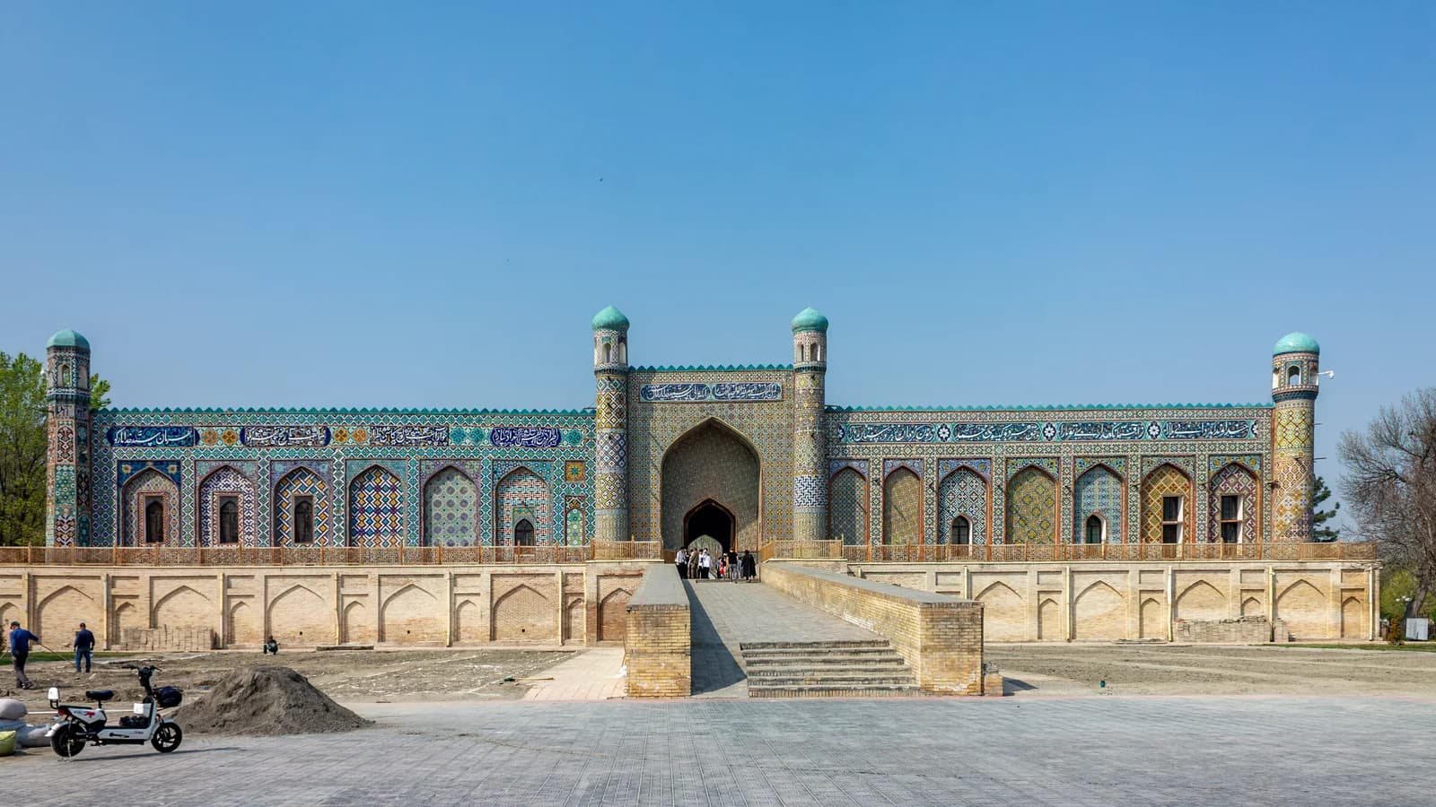
The line connects Fergana with Kokand through the settled valley landscape and includes a detour into Margilan. Its original waypoints mention a market, silk-related visits and the Khudayar Khan Palace in Kokand. These are the recorder's references, not a promise that each business or workshop currently welcomes visitors. The track ends near the Kokand railway-station area rather than at the palace, so plan your final destination separately.
Elviajerobicicletero recorded this journey on 16 September 2021 in the car category. Despite the author's username, it is not published here as a cycling route. The GPX contains 4,734 track points across about 110.48 km, with a largest adjacent gap of roughly 351 m. It is a recorded itinerary, not turn-by-turn navigation: current signs, one-way systems, restrictions and roadworks take priority over an old line. Do not interpret pauses or source waypoints as verified parking, food availability or scheduled visits.
Use the track to decide how to connect the three cities, then confirm any museum or workshop visit directly. Walking time inside each destination is additional to the driving distance. The photograph shows the Khudayar Khan Palace as recorded by ElenaLitera in April 2024; it is destination context, not a photograph from this GPX journey. The original GPX and author attribution are preserved. Route conditions and visitor access have not been checked on the ground by VanLife.uz.
Route map
Track line and route waypoints
Travel map
Routes and useful places
Use search, trust status and layer toggles to plan the next stop.
visible in current filters
Camera sources: kg.camera (ElCat LLC) and youwebcams.org. Broadcasts and weather readings depend on the provider. kg.camera / youwebcams.org
Nearby results
Nearby results
Run a nearby search from your live position or the current map center.
Waypoints
Useful points shown on the route
- 01Track point 140.378330, 71.786319
- 02Track point 473440.519175, 70.928685
Access
Trailhead and approach planning
Recorded drive. Useful as a planning lead, not as a final guarantee. Treat on-site checks as mandatory.
Safety
Before you commit to the day
Pending field review. Keep normal field checks for weather, closures and local access limits.
Season and timing
Best time to visit
Check current conditions
What to bring
Useful equipment for this route
Carry offline navigation, weather margin and a kit that matches the surface and elevation profile.
GPX use
How to use the track responsibly
Current GPX package exposes 4734 geometry points and 0 named waypoints in the public layer.
Unknowns
What still needs field confirmation
Useful as a planning lead, not as a final guarantee. Treat on-site checks as mandatory.
Nearby
Useful stops around the route
Browser location is requested only after you click the location button.