 VanLife.uz
Weather at the route start
Loading weather
Overview
What to expect
This is a southbound recorded stage rather than a complete expedition from Nukus. The GPX starts around 44.504557, 58.231680 and ends on the northern side of Muynak, around 43.791072, 59.031376. Its value is the detailed line between the remote Aral landscape and the town: 16,235 points over approximately 130.97 km. The largest adjacent gap is about 50 m; no missing section has been filled by interpolation.
The source records an off-road activity dated 5 June 2024 by bibibärlauch. Treat the line as evidence of that journey, not a current navigable road. Shorelines, soft ground and approaches can change. Before committing to a remote section, discuss the exact corridor and return options with a locally experienced operator. Arrange suitable vehicle support, fuel, water, communications and offline mapping; none of these services is established by this GPX. Do not infer a permitted campsite from a pause or waypoint.
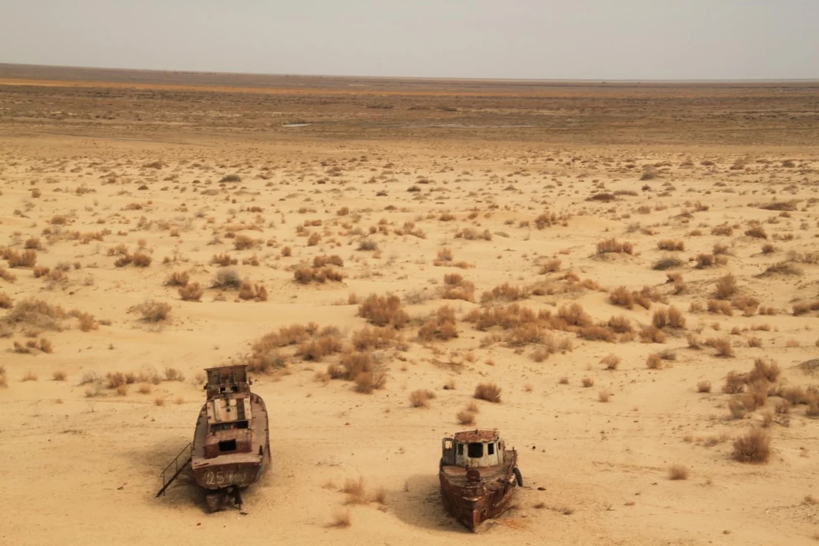
Muynak's former-shore ship remains provide context for the destination, but the illustration is Sebastian Kluger's photograph from March 2011, not a recent condition report or a photograph taken by the track author. The GPX finish should not be mistaken for the entrance to the ship cemetery. The original file and author credit are retained. This page is desk-reviewed and still requires a field check before relying on it for a journey.
Route map
Track line and route waypoints
Travel map
Routes and useful places
Use search, trust status and layer toggles to plan the next stop.
visible in current filters
Camera sources: kg.camera (ElCat LLC) and youwebcams.org. Broadcasts and weather readings depend on the provider. kg.camera / youwebcams.org
Nearby results
Nearby results
Run a nearby search from your live position or the current map center.
Waypoints
Useful points shown on the route
- 01Track point 144.504557, 58.231680
- 02Track point 1623543.791072, 59.031376
Access
Trailhead and approach planning
Off-road drive. Useful as a planning lead, not as a final guarantee. Treat on-site checks as mandatory.
Safety
Before you commit to the day
Pending field review. Keep normal field checks for weather, closures and local access limits.
Season and timing
Best time to visit
Check current conditions
What to bring
Useful equipment for this route
Carry offline navigation, weather margin and a kit that matches the surface and elevation profile.
GPX use
How to use the track responsibly
Current GPX package exposes 16235 geometry points and 0 named waypoints in the public layer.
Unknowns
What still needs field confirmation
Useful as a planning lead, not as a final guarantee. Treat on-site checks as mandatory.
Nearby
Useful stops around the route
Browser location is requested only after you click the location button.