 VanLife.uz
Air temperature
Loading weather
Overview
What this stop is good for
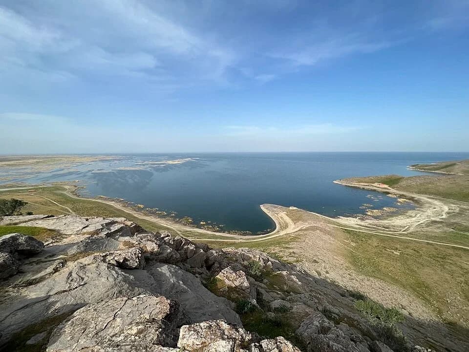
Tuzkan opens out beneath the low Pistalitov hills in Jizzakh Region. Its broad water surface, pale shore and low, open horizon give it a very different character from Uzbekistan's mountain lakes. Bays and narrow spits interrupt the shoreline, while rippled shallows change from muted green to deeper blue farther out.
This brackish lake is the southern part of the Aydar-Arnasay system, connected to Aydarkul towards the northwest. The combination of water, dry hills and open sky is the main reason to visit. Different parts of the shore offer quite different views, so arrange a specific permitted shore visit rather than navigating to the lake's central marker.
Confirm local access and protected-area rules before setting out. Do not assume that a visible track permits driving to the water, or that camping, fires, fishing and swimming are allowed. Keep vehicles off fragile shoreline vegetation.
Map preview
Coordinates and nearby route context
Travel map
Routes and useful places
Use search, trust status and layer toggles to plan the next stop.
visible in current filters
Camera sources: kg.camera (ElCat LLC) and youwebcams.org. Broadcasts and weather readings depend on the provider. kg.camera / youwebcams.org
Nearby results
Nearby results
Run a nearby search from your live position or the current map center.
Nearby
Nearby useful stops
Browser location is requested only after you click the location button.