 VanLife.uz
Air temperature
Loading weather
Overview
What this stop is good for
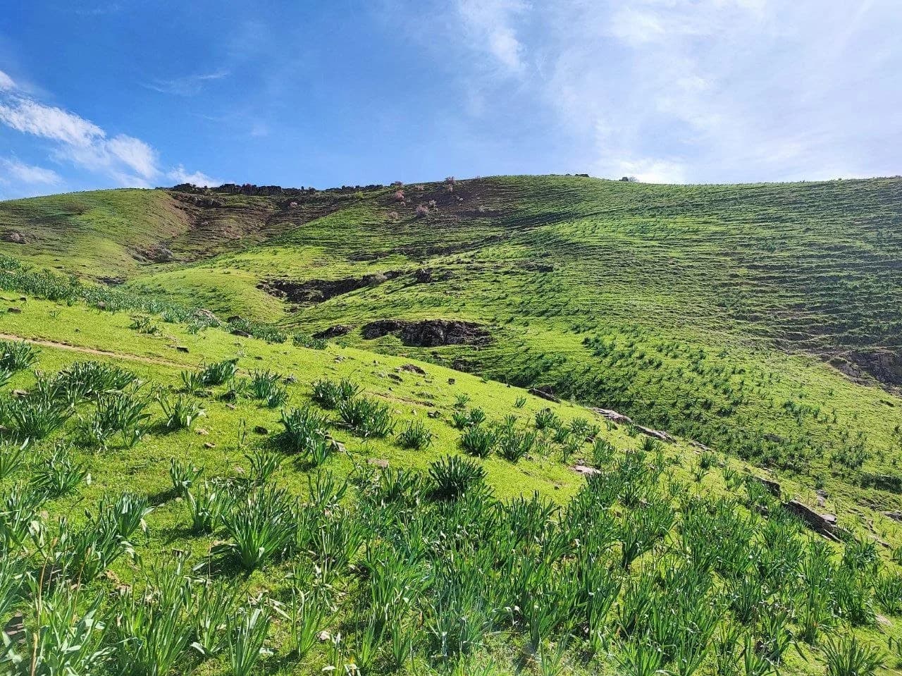
Tavaksay is a landscape walk rather than a roadside waterfall stop. The lower valley opens between rounded hills, with the stream providing a clear visual thread through the folds of the terrain. In the supplied March photograph, fresh green slopes and flowering shrubs define the scene. That spring view should not be taken as a promise of the same vegetation or water flow throughout the year.
The pin at 41.576098, 69.658064 comes from the beginning of a supplied hiking recording. It is an orientation point for the lower approach, not the location of the largest waterfall and not proof of public parking. Leave the vehicle only where local access permits and where it will not obstruct residents or the track. Continue on established paths; the stream and canyon sections are a separate part of the walk.
The site already has the route “Tavaksay waterfalls hike”. Use its route page to examine the actual line and recording details. The GPX downloaded from this location card contains a place marker only, not a new hiking track. Do not follow a straight line from a car-navigation app into the gorge. After rain or during high water, reassess crossings and the return route locally; carry drinking water rather than assuming stream water is suitable.
Photo and trip-report source: TrekkingClubNews, https://t.me/TrekkingClubNews (report of 28 March 2026: https://t.me/TrekkingClubNews/17841). Published with permission confirmed by the project owner. The description is original; contact details and the group's booking information are not reproduced. Access and conditions have not been field-verified by VanLife.uz.
Map preview
Coordinates and nearby route context
Travel map
Routes and useful places
Use search, trust status and layer toggles to plan the next stop.
visible in current filters
Camera sources: kg.camera (ElCat LLC) and youwebcams.org. Broadcasts and weather readings depend on the provider. kg.camera / youwebcams.org
Nearby results
Nearby results
Run a nearby search from your live position or the current map center.
Nearby
Nearby useful stops
Browser location is requested only after you click the location button.