 VanLife.uz
Air temperature
Loading weather
Overview
What this stop is good for
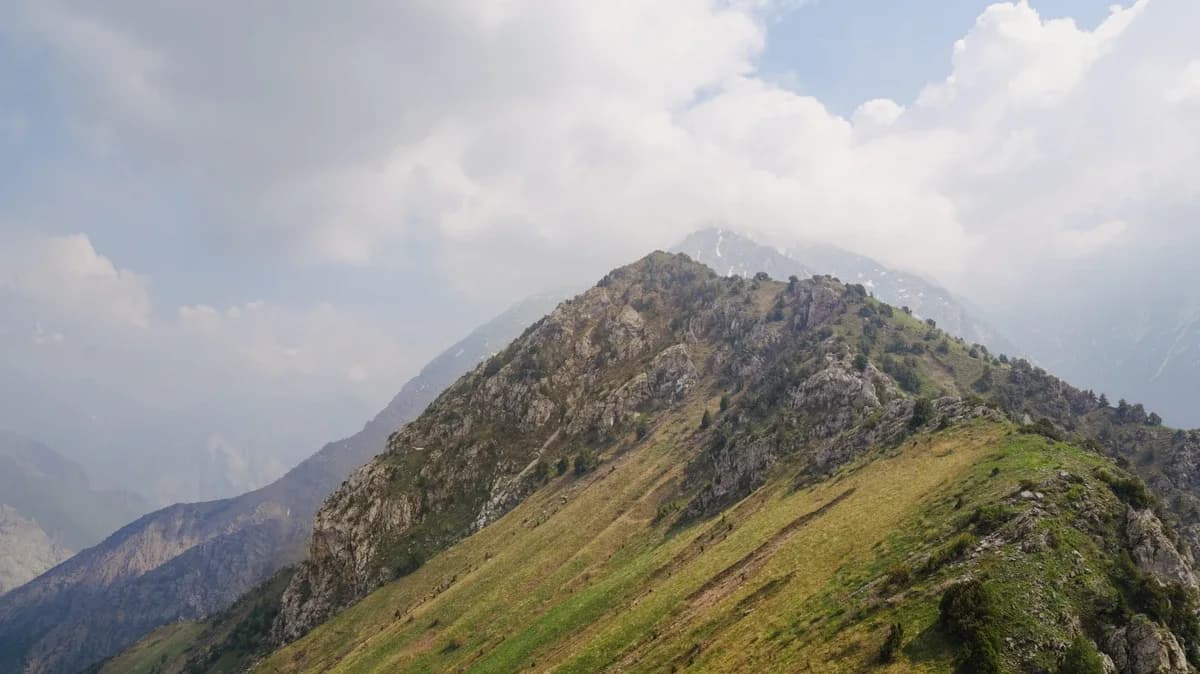
Patandazbashi is a mountain destination in the Tashkent Region, near Chimgan and the Charvak area. The source album shows green foothills, a wooded approach, open slopes and rocky ridges. Views toward the reservoir and surrounding mountains are part of the appeal, but clouds may hide them. The photographs show an earlier visit, not current conditions.
The GPX was recorded on 15 September 2024. Its 318 points form one continuous uphill segment of 5.20 km, from 41.572181, 70.095570 to 41.552673, 70.088631. The summit waypoint is at 41.552825, 70.088616. Recorded elevations rise from about 951 to 1825 m; the source waypoint name gives a different summit altitude, so no surveyed height is claimed.
Plan this as a walking ascent, not camper access to the summit. The file does not record the descent. Returning along the same line would mean about 10.4 km in total; that is a planning estimate, not a recorded round trip. Confirm the trailhead approach, parking and local access before departure. Carry water, suitable footwear and an offline map; wet ground, snow and poor visibility can change the difficulty. The older track does not establish present safety, drinking-water availability or camping permission.
The location download contains the summit waypoint only. For the continuous line, open the separate Patandazbashi hiking route.
Map preview
Coordinates and nearby route context
Travel map
Routes and useful places
Use search, trust status and layer toggles to plan the next stop.
visible in current filters
Camera sources: kg.camera (ElCat LLC) and youwebcams.org. Broadcasts and weather readings depend on the provider. kg.camera / youwebcams.org
Nearby results
Nearby results
Run a nearby search from your live position or the current map center.
Nearby
Nearby useful stops
Browser location is requested only after you click the location button.