 VanLife.uz
Air temperature
Loading weather
Overview
What this stop is good for
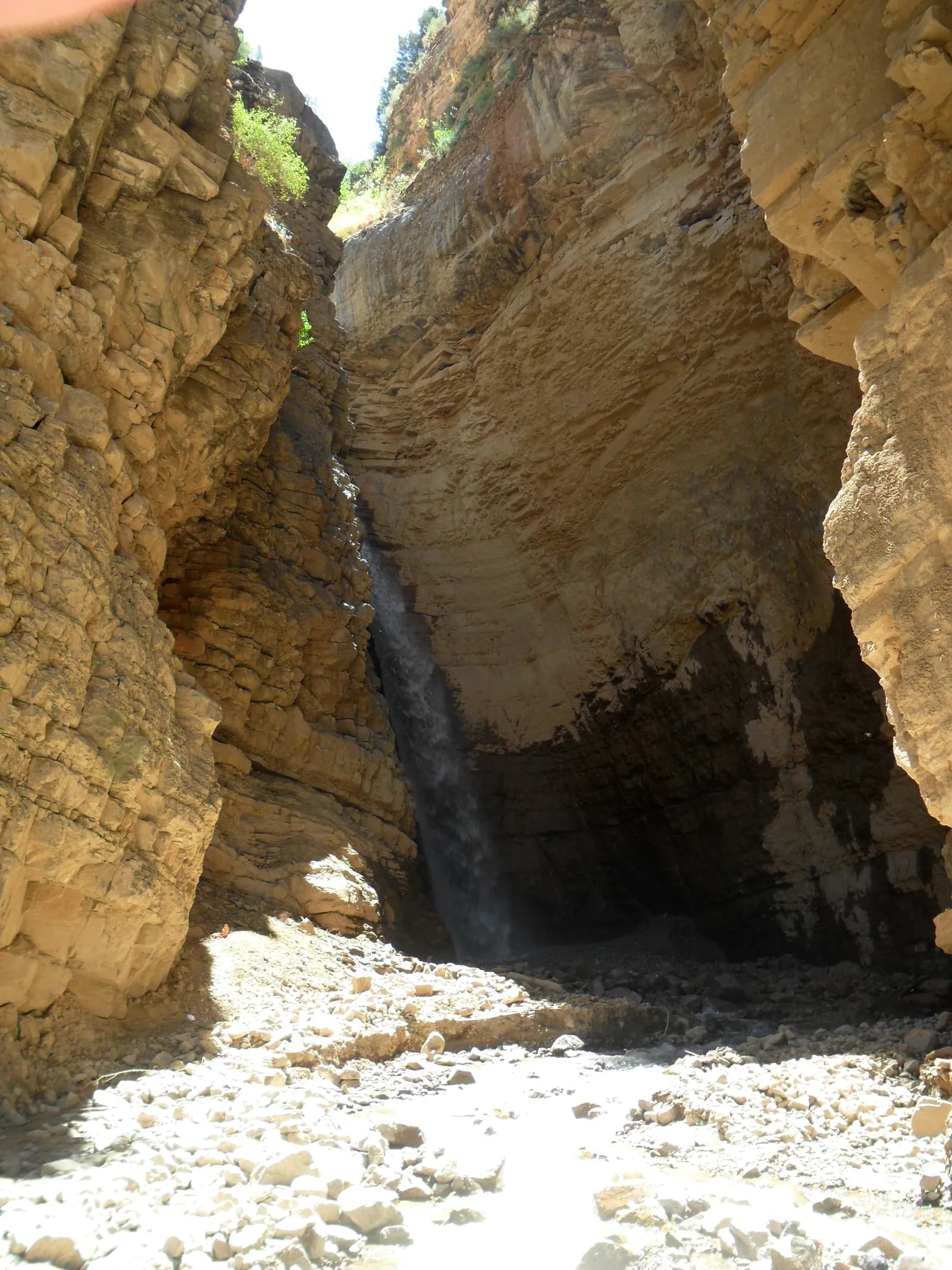
The appeal is the gorge itself: layered rock, shade and the sound of the waterfall. The published photograph was taken in July 2014 and is a record of the place, not evidence of today's water flow or path condition.
Map preview
Coordinates and nearby route context
Travel map
Routes and useful places
Use search, trust status and layer toggles to plan the next stop.
visible in current filters
Camera sources: kg.camera (ElCat LLC) and youwebcams.org. Broadcasts and weather readings depend on the provider. kg.camera / youwebcams.org
Nearby results
Nearby results
Run a nearby search from your live position or the current map center.
Amenities
Reported facilities and practical fit
Drinking water, toilets, shops and waste collection have not been verified. Bring your own water and carry all rubbish out; the waterfall is not a verified drinking-water source.
Access and safety
Use before arrival
The tourism source places Paltau near the Tashkent-Burchmulla road. Before leaving the main road, ask locally which approach is open and whether permission or a guide is required. The single-point GPX marks the attraction only; it does not provide a hiking track.
Wet stones and loose rock require care. Do not stand below unstable cliffs or enter the gorge during heavy rain. A photo opportunity is not a reason to cross fast water or approach an exposed edge.
Unknown
Current opening rules, fees, mobile coverage and seasonal restrictions need a fresh local check. Coordinates are based on a geotagged photograph and are approximate.
The tourism source places Paltau near the Tashkent-Burchmulla road. Before leaving the main road, ask locally which approach is open and whether permission or a guide is required. The single-point GPX marks the attraction only; it does not provide a hiking track.
Wet stones and loose rock require care. Do not stand below unstable cliffs or enter the gorge during heavy rain. A photo opportunity is not a reason to cross fast water or approach an exposed edge.
Road condition
How to treat the final approach
The final approach has not been surveyed for surface, clearance or turning space. Check the road in daylight and stop before any section unsuitable for your vehicle.
Family use
Comfort expectations
Choose the walk to match the least experienced person in the group. Keep children away from the water and cliff edges, and allow enough daylight for the return.
Vehicle access
What matters for self-drive setup
This is a nature attraction, not a campsite. Overnight parking, access for large campers and waste-disposal facilities are not confirmed.
Unknowns
What still needs a field check
Current opening rules, fees, mobile coverage and seasonal restrictions need a fresh local check. Coordinates are based on a geotagged photograph and are approximate.
Nearby
Nearby useful stops
Browser location is requested only after you click the location button.