 VanLife.uz
Air temperature
Loading weather
Overview
What this stop is good for
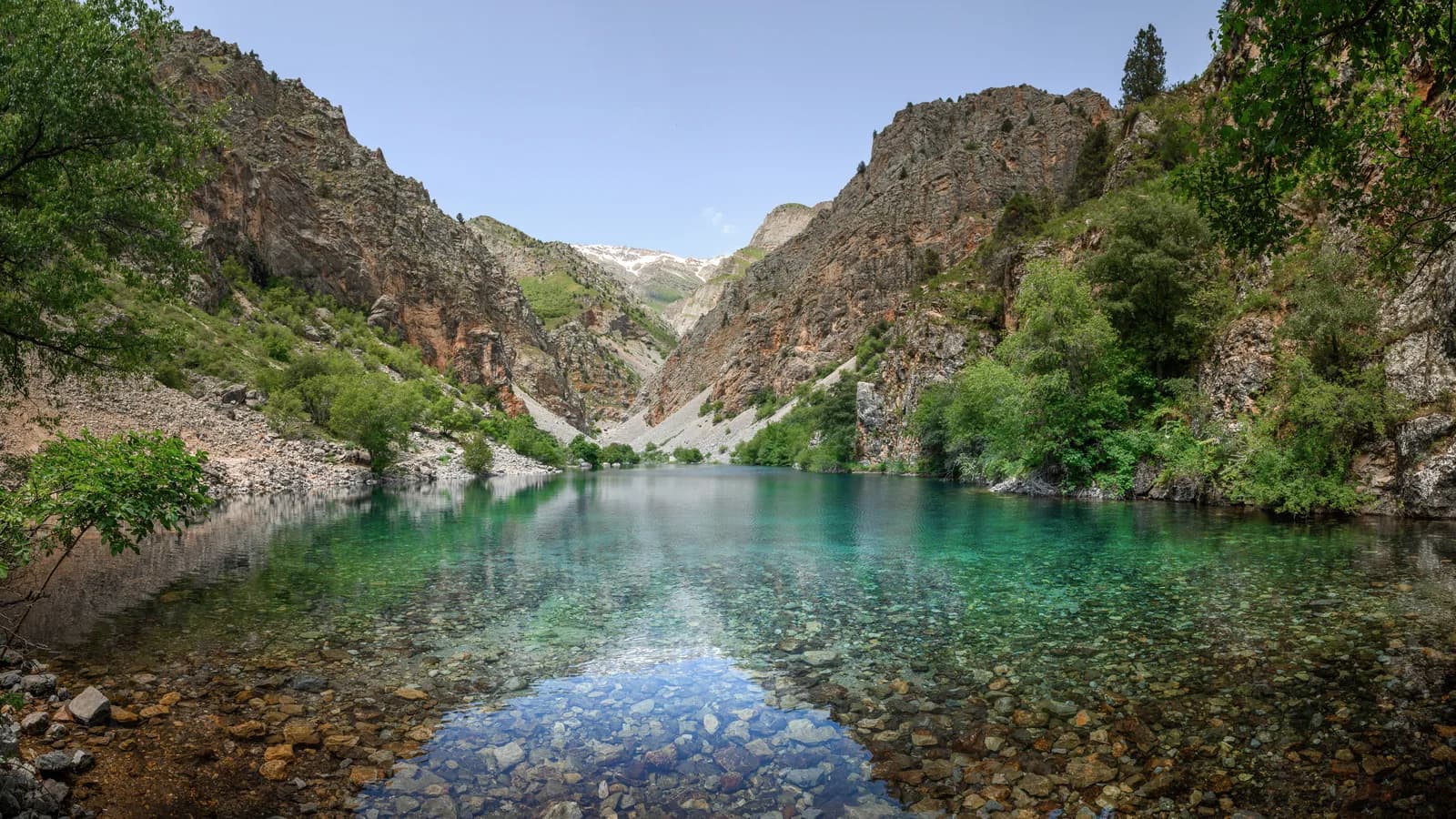
The lake sits within a mountain setting rather than a serviced waterfront. Make time to look at the surrounding slopes and shoreline, and stay on established paths instead of creating new shortcuts through fragile ground.
Map preview
Coordinates and nearby route context
Travel map
Routes and useful places
Use search, trust status and layer toggles to plan the next stop.
visible in current filters
Camera sources: kg.camera (ElCat LLC) and youwebcams.org. Broadcasts and weather readings depend on the provider. kg.camera / youwebcams.org
Nearby results
Nearby results
Run a nearby search from your live position or the current map center.
Amenities
Reported facilities and practical fit
Do not depend on a shop, drinking-water tap, toilet or phone signal beside the lake. Carry water, food and an offline map. No campsite or service facilities are confirmed at the marker.
Access and safety
Use before arrival
Uzbekistan Travel places the Urungach lakes in the Ugam-Chatkal area, roughly 150 km from Tashkent. That regional distance is not a measured route to this pin. Confirm the approach, access rules and return transport before travelling; no continuous hiking GPX has been verified for this entry.
Steep banks and loose stones call for careful footing. Swimming safety, depth and rescue provision are unknown. Do not treat clear water as evidence that it is safe to enter or drink.
Unknown
Check current water conditions, weather, access restrictions and path condition shortly before departure. The approximate shoreline marker comes from a geotagged photograph, not a surveyed trailhead.
Uzbekistan Travel places the Urungach lakes in the Ugam-Chatkal area, roughly 150 km from Tashkent. That regional distance is not a measured route to this pin. Confirm the approach, access rules and return transport before travelling; no continuous hiking GPX has been verified for this entry.
Steep banks and loose stones call for careful footing. Swimming safety, depth and rescue provision are unknown. Do not treat clear water as evidence that it is safe to enter or drink.
Road condition
How to treat the final approach
The last vehicle approach and suitable parking need local confirmation. Do not follow a navigation app onto a walking path; the lake pin is not a driveable destination.
Family use
Comfort expectations
Agree a turnaround time and choose a walk that everyone can complete on the return. The shore is not a supervised bathing area; children need close supervision.
Vehicle access
What matters for self-drive setup
A camper can serve as transport to a locally agreed parking place, not as access to the lakeshore. Overnight stays and permission to camp are unverified.
Unknowns
What still needs a field check
Check current water conditions, weather, access restrictions and path condition shortly before departure. The approximate shoreline marker comes from a geotagged photograph, not a surveyed trailhead.
Nearby
Nearby useful stops
Browser location is requested only after you click the location button.