 VanLife.uz
Air temperature
Loading weather
Overview
What this stop is good for
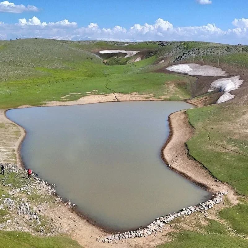
Kattakul lies on the Kyrktau plateau of the Zarafshan range, near the boundary between Qashqadaryo and Samarkand regions. The lake fills a broad rounded hollow among grassy slopes. Its irregular bank curves around grey-green water, with exposed earth and stones along the margin and patches of snow in nearby folds of the plateau.
This is a seasonal lake in a karst landscape, where water and rock are closely connected. Its appearance depends on the time of year: do not expect the shoreline or water coverage to match a photograph on every visit. The open terrain and gently rounded basin distinguish Kattakul from the narrow, cliff-bound lakes of the deeper mountain valleys.
Confirm whether the lake holds water, the permitted approach and local guide availability before travelling. A plateau location does not establish vehicle access or a safe path across karst ground. Parking, facilities and permission to camp or enter the water are unverified; keep clear of holes and unstable snow edges.
Map preview
Coordinates and nearby route context
Travel map
Routes and useful places
Use search, trust status and layer toggles to plan the next stop.
visible in current filters
Camera sources: kg.camera (ElCat LLC) and youwebcams.org. Broadcasts and weather readings depend on the provider. kg.camera / youwebcams.org
Nearby results
Nearby results
Run a nearby search from your live position or the current map center.
Nearby
Nearby useful stops
Browser location is requested only after you click the location button.